That Drone Company
Serious DJI Terra Users
Subscription · £10/mo
 Get TACT →
 Get Terra Monitor →
 Run the Benchmark →
TACT – For DJI Terra V2
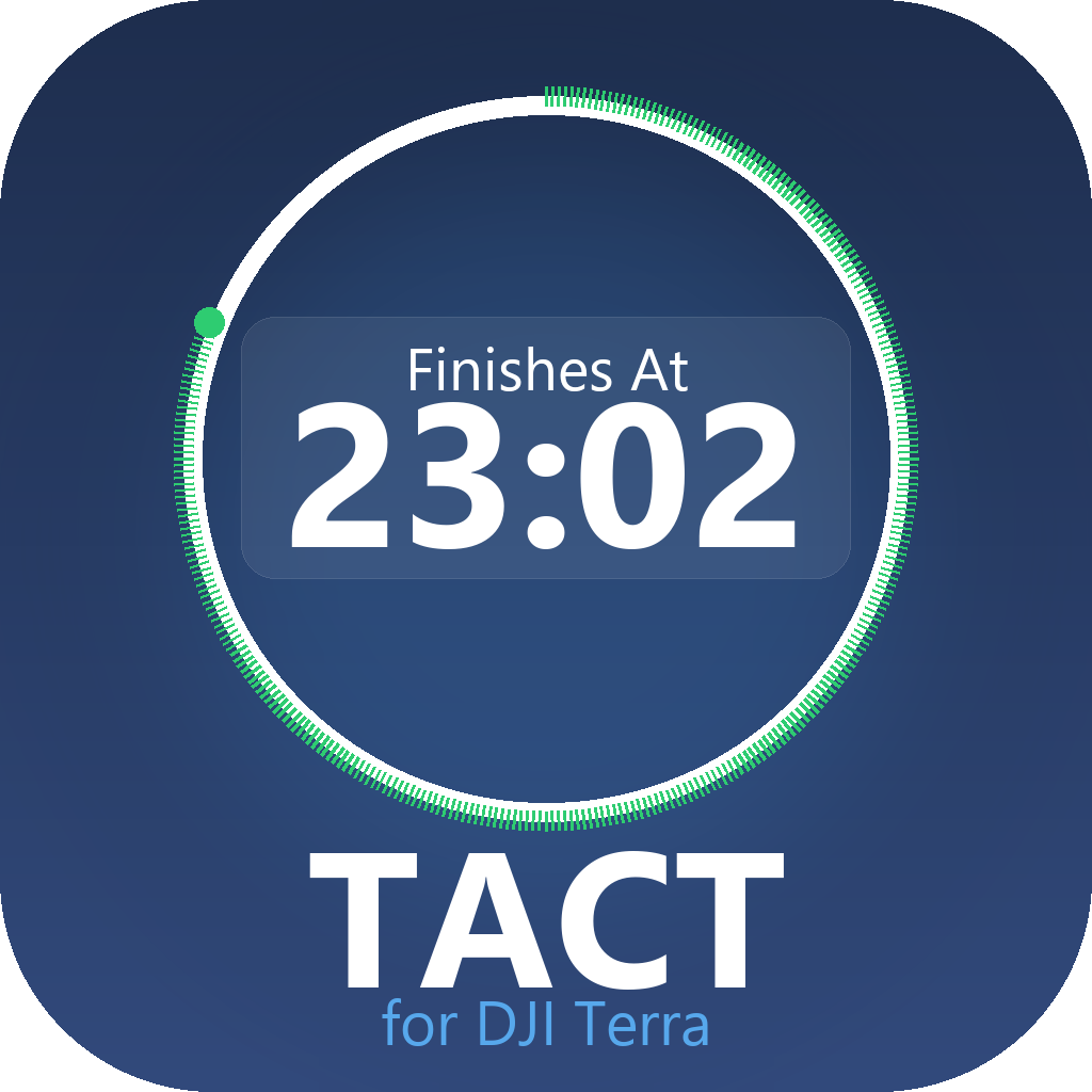
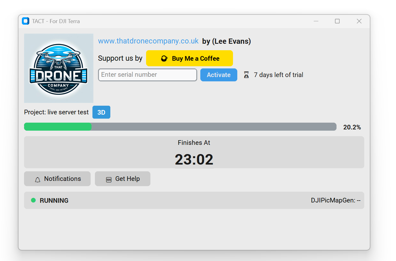
1,000 images or 10,000 — DJI Terra will never tell you when it'll finish. TACT will tell you the time it does!
- Actual finish time — not just a percentage
- Works on any project size — 1,000 images or 10,000
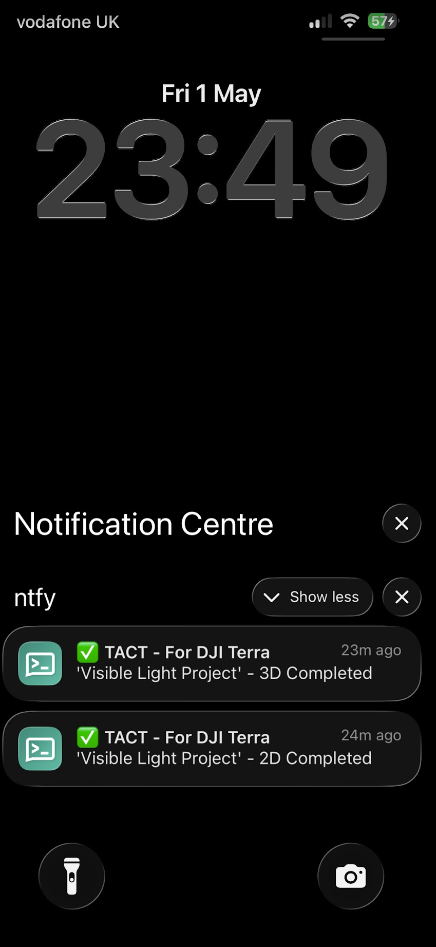
- Leave the office — get a phone notification via the free NTFY app the moment your project finishes
- 14-day free trial included
- Works silently in the background
Leave the office — TACT pings your phone the moment your project finishes via the free NTFY app. No account needed.
14-day free trial · Cancel any time
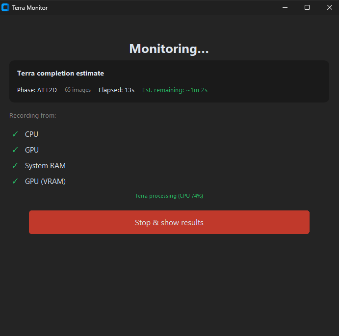
Free Benchmark ToolTerra Monitor
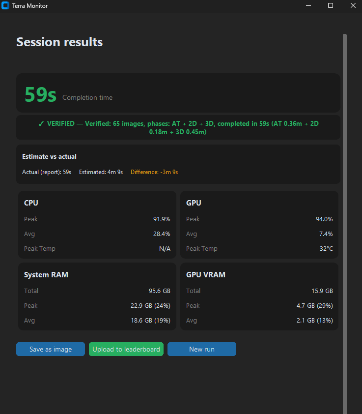
Nobody knew what hardware actually mattered for DJI Terra — until now. Terra Monitor is the world's only dedicated benchmark for DJI Terra. Run the test, see every stat, own the leaderboard.
- 65 real Matrice 4E images — identical test for every machine
- Full telemetry: CPU & GPU temps, usage, RAM & VRAM
- Spoiler: RTX 5090 beats RTX 5080 by just 2 seconds
- 47 entries worldwide — where does your rig rank?
"Up to now I couldn't find a way to do this until I found Terra Monitor."
— Gabriele Romagnoli, Dell Ambassador
47
Submissions
4m 11s
Fastest Time
#1
RTX 5090
Live monitoring as DJI Terra processes — CPU, GPU, RAM & VRAM all captured in real time.
Free · No subscription · Windows only